









Signed for printing 27.07.2026
We present a slightly abridged and adapted translation of the review article “We must stop fossil fuel emissions to protect permafrost ecosystems” (Abbott et al., 2022). The paper was prepared by a large international group of researchers and published in the peer-reviewed journal “Frontiers in Environmental Science”, issued by the Swiss publisher “Frontiers Media SA”. The article is available in open access on the publisher’s website (frontiersin.org) under the CC BY 4.0 license (https://creativecommons.org/licenses/by/4.0/), which permits sharing, translating, adapting, and building upon the material, provided that the types of changes are indicated and the original source is properly cited. In our case, the full reference to the original publication (Abbott et al., 2022) for the translation is provided at the end.
Climate change is an existential threat to the vast global permafrost domain. The diverse human cultures, ecological communities, and biogeochemical cycles of this tenth of the planet depend on the persistence of frozen conditions. The complexity, immensity, and remoteness of permafrost ecosystems make it difficult to grasp how quickly things are changing and what can be done about it. Here, we summarize terrestrial and marine changes in the permafrost domain with an eye toward global policy.
While many questions remain, we know that continued fossil fuel burning is incompatible with the continued existence of the permafrost domain as we know it. If we fail to protect permafrost ecosystems, the consequences for human rights, biosphere integrity, and global climate will be severe. The policy implications are clear: the faster we reduce human emissions and draw down atmospheric CO2, the more of the permafrost domain we can save. Emissions reduction targets must be strengthened and accompanied by support for local peoples to protect intact ecological communities and natural carbon sinks within the permafrost domain.
Some proposed geoengineering interventions such as solar shading, surface albedo modification, and vegetation manipulations are unproven and may exacerbate environmental injustice without providing lasting protection. Conversely, astounding advances in renewable energy have reopened viable pathways to halve human greenhouse gas emissions by 2030 and effectively stop them well before 2050.
The authors call on leaders, corporations, researchers, and citizens everywhere to acknowledge the global importance of the permafrost domain and work towards climate restoration and empowerment of Indigenous and immigrant communities in these regions.
Authors: Abbott B.W., Brown M., Carey J.C., Ernakovich J., Frederick J.M., Guo L., Hugelius G., Lee R.M., Loranty M.M., Macdonald R., Mann P.J., Natali S.M., Olefeldt D., Pearson P., Rec A., Robards M., Salmon V.G., Sayedi S.S., Schädel C., Schuur E.A.G., Shakil S., Shogren A.J., Strauss J., Tank S.E., Thornton B.F., Treharne R., Turetsky M., Voigt C., Wright N., Yang Y., Zarnetske J.P., Zhang Q., Zolkos S.
In 2016, an article by Slovak geotechnical engineers titled “The role of geotechnical monitoring at design of foundation structures and their verification – part 1” (Drusa et al., 2016) was published in the international peer-reviewed scientific journal “Civil and Environmental Engineering”. It is of particular interest that a continuation of this study (part 2) was published in 2021. The five-year gap between these two publications is explained by the fact that they had different objectives and examined the behavior of the same building (the Aupark shopping and entertainment center in the Slovak city of Žilina) at different stages of its life cycle. While in the first part the authors described the engineering-geological conditions of the construction site and compared calculated settlements with the results of geodetic measurements during the construction phase (up to the completion of the building frame), the second part focused on analyzing the reliability of the adopted design decisions by comparing modeling results with the actual behavior of the building already under operational load. The pause was necessary to accumulate long-term monitoring data and to apply new calculation technologies for project verification. Today, we present a slightly abridged and adapted translation of the first part of this paper, which is available in open access under the CC BY 4.0 license (the translation of the second part will be published in the near future). The full reference to the source of the translation (Drusa et al., 2016) is provided at the end.
For a long time, design of the square foundations has not posed a problem in engineering practice. Foundations are designed on the basis of determining the bearing capacity of the subsoil, where irregularities in its determination oftentimes affect the efficiency (economy), while possible failures of bearing resistance of foundation soil are rare. More important factor is the resulting deformation of second limit state under consideration - settlement, relative settlement, tilting and excessive deformation.
The current pressure on the cost reduction of design preparation and obtaining important data from geotechnical survey often results in many cases into adverse effects of settlement and differential settlement of foundations of the buildings. The question lies in a variety of analytical methods for assessing the service ability of limit states used in European countries as well as the underestimation of the proposal risks.
The authors of the article (Drusa et al., 2016) want to document the fact that the most important influence on adequate and safe design is the most accurate determination of geotechnical parameters and the appropriate selection of the calculation method (for the purposes of explanation, Monte Carlo simulation technique was used to test a variety of geotechnical parameters, which will be presented in the second part of the article).
If all construction processes are carried out successfully, rarely are the buildings evaluated once again. However, when the opportunity to participate in the stage of engineering survey and collection of geotechnical parameters as well as the control of the construction process by tools of geotechnical monitoring presents itself, it is valuable to perform the analysis of the entire process for pointing out hidden risks.
We present a slightly abridged and adapted translation of the paper by Slovak geotechnical engineers titled “The Role of Geotechnical Monitoring in Foundation Design and Verification of Adopted Decisions. Part 2” (Drusa et al., 2021). It was published in the international peer-reviewed journal “Civil and Environmental Engineering” in 2021 – five years after the first part of this work. The five-year gap between the two publications is explained by their different objectives and the fact that they examined the behavior of the same object (the Aupark shopping and entertainment center in Žilina, Slovakia) at different stages of its life cycle. In the first part, the authors briefly described the engineering-geological conditions of the site, the peculiarities of the designed building, the chosen type of its foundations and compared the calculated settlements with geodetic measurements carried out during construction. In the second part, the authors’ attention was focused on analyzing the reliability of the adopted design decisions by comparing computer modeling results with the actual behavior of the building under operational loads. The pause between the two parts was necessary to accumulate long-term monitoring data and apply new computational technologies for project verification. The full reference to the original source (Drusa et al., 2021), which is available under the CC BY 4.0 license, is provided at the end.
The main aim of the article is to demonstrate that the design of spread foundations for the commercial center building was successful. The long-term geotechnical monitoring allowed to check the efficiency of the design and calculate its reliability taking into account the measured (real) settlements.
Geotechnical engineers do not have many opportunities to evaluate their designs, especially when everything is completed successfully. The presented case study is one of the examples that can be evaluated in terms of the reliability index of the design adjusted on the basis of real geodetic measurement results. The reliability index of the selected foundations was calculated using probabilistic methods based on the deterministic approach. In order to evaluate thousands of statistical data combinations, a programming tool in Python was developed for batch calculations of foundation settlements using PLAXIS software. The discussion part of the article also considers the current state of the reliability theory in European structural standards.
This article examines the characteristics of the ecological-geological systems (EGS) of the railway transport-communication complexes in Belarus. Despite their key role in the country's transport infrastructure and their significant distribution, these systems remain virtually unexplored, with only fragmentary and disparate information available on their abiotic and biotic components.
Based on the classification of natural and man-made EGS in the Republic of Belarus, which was previously developed by the authors, as well as on the systematics of the ecological-geological systems of transport-communication complexes, this article attempts to compile a general description of the EGS of railway complexes in this country, to identify and characterize the features of their abiotic (lithotope, hydrotope, atmotope), bioinert (edaphotope) and biotic (microbiocenosis, phytocenosis, zoocenosis, and society) components.
The identified patterns and features of the ecological-geological systems of the railway transport-communication complexes in Belarus can be considered common to similar EGS in Russia, which must be considered in engineering-ecological surveys and studies.
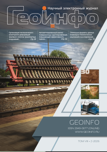
Currently, digitalization is being actively implemented in the construction industry, including the creation of digital twins for engineering structures. Monitoring of structures and foundation soils allows for updating their digital models based on real-world data. However, traditional deformation measurement methods using geodetic marks fail to provide a complete pattern and are associated with a number of difficulties. This paper discusses the principles for organizing geotechnical monitoring of transport infrastructure roadbeds on soft soils using a new approach to inclinometer measurements of settlements and horizontal displacements. The approach allows for a more effective analysis of deformation patterns in soil foundations and embankments. The organizational and technical features of applying this method, as well as its economic feasibility are described.
The combined consideration of the Le Chatelier–Braun principle, the theory of linear irreversible processes, and the theory of dissipative structures covers the entire range of possible states of thermodynamic systems. The Le Chatelier–Braun principle holds for small departures from equilibrium, when generalized forces are equal to zero. In linear irreversible processes, generalized forces remain sufficiently weak. In contrast, dissipative structures arise and are maintained through the exchange of energy and matter with the external environment under conditions far from equilibrium. This paper presents several concepts of modern thermodynamics with the aim of further analyzing well-known phenomena and preventing misinterpretation and misuse of the theory. The fundamental provisions of this theory were originally developed in relation to chemistry. However, they are of broader significance and can be applied in other branches of science, in particular in hydroaerodynamics and thermal physics. A proof of the Le Chatelier–Braun principle in the author’s formulation is presented below. Brief information is also given on laminar (linearly nonequilibrium) and turbulent (nonlinearly nonequilibrium) flows. The “classic textbook” example of dissipative structures, namely Rayleigh–Bénard cells, is analyzed. The possibility of using the term “dissipative structure” with respect to foundation soils in soil mechanics is discussed. A special place is given to Bottomley’s experiment on the passage of a weighted wire through ice. The conclusions drawn from this experiment are of great importance for frozen ground mechanics. The paper shows how energy, both thermal and mechanical, is distributed in each of the examples considered.
The paper presents an integrated approach to karst hazard assessment using geoinformation systems (GIS) and Earth remote sensing (ERS) data. This approach enables rapid and reliable karst hazard assessment along designed linear infrastructure. It is demonstrated for the Pivovarovo karst area in the Vladimir Region, Russia. A significant methodological contribution to solving such problems is the development of a Python-based tool for the automated morphometric analysis of karst features, including the estimation of their sizes and orientation. The proposed approach is an efficient solution of particular issues of karst hazard assessment because it provides rapid processing of large datasets and high-quality results. These advantages can be used to support design decisions.
The article addresses the issues of digital exchange of engineering geological data during the transition of the construction industry to building information modeling (BIM) technologies. It is shown that the current practice of presenting the results of engineering geological site investigations and special engineering geological (geotechnical) research remains fragmented and predominantly based on tabular, CAD, and proprietary software-dependent formats. This hinders the automated use of data in computational software packages, GIS, and digital information models of capital construction objects (DIM CCO).
A comparative analysis of the main groups of data exchange formats applicable for transmitting engineering geological and geospatial information (XML, JSON, GML, AGS, DIGGS, GeoSciML, Geo3DML, GIS, CAD, IFC 4.3) was carried out based on the criteria of machine-readability, 3D geometry support, semantic completeness, transmission of factual data and metadata, specification accessibility, and suitability for integration into DIM CCO.
It has been established that none of the considered formats fully ensures the integrated digital transmission of engineering geological information across all stages of its formation (from the analysis of archival materials and processing of field and laboratory data to the construction of a verified 3D engineering geological model that conforms to geological regularities, principles of soil mass typification, and regulatory requirements). A separate issue remains the transmission of soil attribute characteristics and metadata while maintaining a traceable link between actual investigation results, their interpretation, and the 3D model.
The necessity of transitioning from fragmented file exchange to a multi-level architecture for engineering geological data management is substantiated. This architecture should ensure the storage of verifiable factual data, formation of an interpreted model, transmission of parameters and design characteristics of soils into specialized software packages, information integration into DIM CCO, and preparation of digital materials for state and non-state expertise.
 наверх


 Поделиться

 Поделиться
 Скопировать ссылку









 Скопировать ссылку
 Vk
 Telegram
 Viber
 WhatsApp


 Оформить подписку