










Signed for printing 30.09.2023
In the next 50 years, with continued climate warming on the planet, according to scientists’ supposals, the frequency and intensity of rains will increase. Stormwater flows will more actively wash away the fertile layers of the earth and also transport pollutants over long distances. It is more difficult to protect soil from erosion caused by rainfall than from erosion caused by meltwater.
The greatest danger awaits Africa, Southeast Asia, and South America, where even now the scale of water erosion is large and there are few protective measures. In Russia, the areas at risk are smaller, but they are concentrated mainly where the soils are the most valuable and produce the highest yields.
This was discussed at the webinar “Global Water Erosion: the fundamental problems and applied significance” by Valentin Golosov Ph.D. (Geography), leading researcher at the Research Laboratory of Soil Erosion and Channel Processes of the Faculty of Geography of Lomonosov Moscow State University.
The cycle of such free webinars started in September 2023. They are organized by the scientific and educational center, established in the spring of 2023 at the Research Laboratory of Soil Erosion and Channel Processes of the Faculty of Geography of Lomonosov Moscow State University. The lectures at the webinars are aimed at popularizing geography and applied knowledge on water erosion, the geoecology of cities, the quality of natural and drinking waters, and the environmental monitoring of marine areas. The listeners are employees of various organizations in Russia and CIS countries, as well as schoolchildren, students and young scientists interested in their further education and career development.
As we have repeatedly told before, customers very often have difficulties with the engineering protection of their facilities, which is associated with using unsuitable technologies or low-quality materials due to the negligence or ignorance of the nuances of such sort of work by of designers. That is why all major manufacturers of mesh protection systems against rockfalls and avalanches spend huge amounts of money on creating and testing relevant technologies and structures, as well as on the development of specialized software for calculations, modeling and designing such kind of systems. But sometimes there are outright falsifications of the protection systems against rockfalls supposedly from well-known manufacturers. And this is a very serious problem.
We talked about how to deal with this, how to prevent the use of fakes and still to prevent dangerous geological processes at objects that require engineering protection, with Tat'yana Gorbacheva, the head of the direction “Engineering protection against hazardous geological processes” of “Maccaferri Gabions CIS” LLC.
This year, “Vorovsky United Plants of Drilling Technique” LLC (“Vorovsky OZBT” LLC) offered drillers a cheaper version of a mobile drilling rig PBU-2 that is on the chassis of a self-propelled tracked trolley, but not on the chassis of KamAZ or other expensive vehicle. This new product is causing cautious interest among customers, but much excitement has not been yet, despite the promised savings of about 5 million rubles.
We talked to several geological engineers and tried to figure out whether such savings are needed, and if so, for whom and when. It turned out that the new kit has its own sales market, although not a very bulk one.
We invite our readers to analyze the prospects and capabilities of the PBU-2 on a self-propelled tracked trolley with the help of the interviewed experts
The construction community is discussing a mandatory transition from paper documentation to electronic one, or more exactly to the xml format
So far, this applies only to companies that carry out work at the expense of budgetary funds and agree their documents with the Main Directorate of State Expertise of Russia and ин regional directorates of expertise. For now, only Section I (“Explanatory Note”) of the project documentation needs to be packaged in this format.
At all the levels, the new rules came into force on the 1st of September, 2023 according to the relevant order of the Ministry of Construction of the Russian Federation. In Moscow, everyone already works according to the new rules. Regions will work so when they are ready.
It is expected that the new electronic form will simplify and speed up the approval of documents, will facilitate the preparation of estimates and will serve as a unified electronic database for every constructed facility. It is expected that construction objects will be built faster by 30% and costs will be reduced by 12%.
In English “xml” means “extensible markup language” that is necessary for transmitting and storing data. To generate an explanatory note in the xml format, you need to download the appropriate program from the Ministry of Construction website. For each type of activity, its own xml scheme is developed.
Users (most often the chief engineer of the project) have three options of activities: figure it out on their own, delegate everything to a programmer, pay for the service to a third-party assistant. Nobody likes wasting time and money.
Nowadays, for entrepreneurs and programmers, there are many events, in the names of which the xml format is mentioned.
In this article, we will tell you what we have learned from webinars and chats of engineering surveyors. And we explain what the xml format is
Are the investors interested in high-quality engineering survey results? If we assume that their goal is to maximize profit from the construction of an investment facility, then yes. However, no. And the main problem, as always, is that most investors simply do not think about the importance of geological study of construction sites. The cost of the engineering survey is so insignificant compared to other work that they simply turn a blind eye to the survey. And no one wants to waste “extra” time. The designer, knowing and taking this into account, makes sure that the structure is safe and meets the allotted budget and that the completion time does not exceed the planned deadlines. And if unforeseen difficulties arise, they can almost always be resolved right on the construction site.
Regarding this complex and ambiguous problem, our interlocutor was Anton Petrakov, the head of the geotechnical design department of OOO “GK “Olimproekt” (Olimproekt Group of Companies LLC).
Every specialist on a construction site defends the technology, that he or she prefers. He or she will find a thousand reasons why his or her choice is the only right one. He of she may be driven by commercial interests. Motivations that are not related to rewards are also strong. They can be: commitment to some idea, laziness, lack of resources. If he or she has learned one method and recruited workers for realization of the method, it’s already too difficult for him or her to change anything.
What can happen when wrong materials and technologies have chosen? Yuriy Harin, associate professor of the Department of Soil Mechanics and Geotechnics at Moscow State University of Civil Engineering, Candidate of Technical Sciences, told about that at the webinar “Construction and design of pile foundations” at the University of the Ministry of Construction.
The questions of this webinar were: the main types of ground bases and foundations, the principles of design in tight urban conditions, insufficient amounts of site investigations (which is common). Much attention was paid to PDT (RIT) piles (built using the Pulse Discharge Technology invented in our country) that are only used in Russia.
In this article, we will focus on the points that aroused the greatest interest among the listeners of the webinar and were discussed in the Telegram chat of the University of the Ministry of Construction.
The topic of human resources is increasingly present in the media space. It is presented in the form of understaffing, population decline. At the state level it is expressed in the form of such national projects as “Labor productivity”, “Public health care”, and “Demography”.
Business is also becoming more and more human-centric, especially when managers convert the time spent by employees on sick leave into rubles. But the most difficult thing is to convince people of the need to take care of their health. They only begin to appreciate it have losing it.
The editorial staff of the ”GeoInfo” journal invited some experts to discuss the topic of engineering surveyors’ labor protection. They told us who is responsible for the collective well-being in this regard, what measures are necessary in the field and office conditions, and what is required for the prevention of diseases.
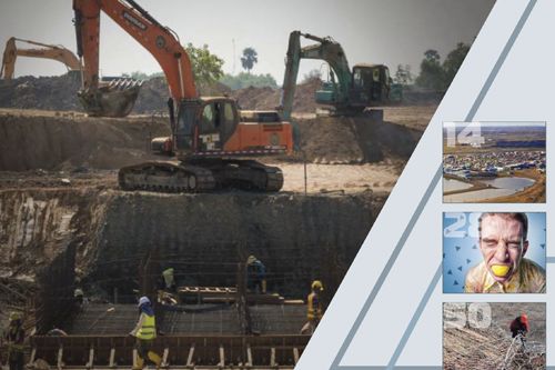
We present an abridged and adapted translation of the report “Finite element analysis of island excavation process of foundation pit” by Chinese geotechnical engineers Changyi Yu, Jie Long, and Mingyue Lu (Yu et al., 2021). This report was presented at the 6th International Conference on Minerals Source, Geotechnology and Civil Engineering in Guangzhou, China. It was also published as an article in the journal “Earth and Environmental Science” by the publishing company of the British scientific society “Institute of Physics” (IOP) that is now virtually international. It is an open access article under the CC BY 3.0 license that allows it to be distributed, translated, adapted, and supplemented, provided that the types of changes are noted and the original source is referred to. In our case, the full reference to the original paper (Yu et al., 2021) used for the adapted translation is given in the end.
“Island” soil excavation is suitable for the construction of large foundation pits because of its high speed, but it requires a stronger support system. In the presented investigation, a finite element simulation was carried out for the construction process of a deep foundation pit with “island” excavation and double-ring support system having four tiers. The simulation process considered the process of step-by-step “island” soil excavation and the stepby-step construction of the support system consisting of four tiers including mainly angle bracing and ring beam bracing. The fields of displacements and stresses were obtained for the support system of the foundation pit and for the soils around it. The paper provides an effective guidance for the safe and smooth development of the foundation pit engineering, and provides a reference method for the engineering analysis of similar objects.
We present a slightly abridged and adapted translation of the report “Technical and economic challenges for Arctic coastal settlements due to melting of ice and permafrost in the Arctic” by Ove Tobias Gudmestad, a Norwegian professor (Gudmestad, 2020). This report was presented at the 6th International Conference on Water Resource and Environment in Tokyo. It was also published as an article in the Earth and Environmental Science journal by the publishing company of the British scientific society “Institute of Physics” (IOP) that is now virtually international. It is an open access article under the CC BY 3.0 license that allows it to be distributed, translated, adapted, and supplemented, provided that the types of changes are noted and the original source is referred to. In our case, the full reference to the original paper (Gudmestad, 2020) for the presented translation is given in the end.
The safety of Arctic coastal settlements is of concern due to melting of the ice cover and the permafrost in the Arctic. The immediate concerns for Arctic coastal settlements are due to a number of causes. These causes can be listed as follows: increased distances of open seas during the storm season, larger storm surges due to longer distances of open water without ice cover, larger waves due to longer fetch lengths, increased permafrost melting caused by warmer summer seasons, larger erosion of melted shoreline, increased number of storms causing accumulation of storm erosion effects, large flooding events destroying houses and facilities as well as infrastructure and fresh water reservoirs. There will be possible offshore slides due to melting of offshore permafrost with potential for tsunami generation, and riverbanks will erode due to the melting of permafrost. Slides caused by increased wetness (for example quick clay slides) will occur and housing and water reservoirs will be damaged. Furthermore, the winter seasons are shorter where winter roads can be utilized and the seasons for hunting from the ice cover is shorter. There will be economic losses for the settlements due to changing climate and in the case of needed relocation of the settlements, the economic costs are huge. The paper discusses the effects of these concerns and will suggest certain mitigating measures, which only to a limited extent can relieve the situation. The ultimate solution will be relocation of the inhabitants and in some cases the settlement may be relocated to safe location further inland.
We present a slightly abridged and adapted translation of the paper “Precipitation intensity: duration based threshold analysis for initiation of landslides in Upper Alaknanda Valley” by researchers from the Indian Institute of Remote Sensing (Bhattacharjee, 2017). This paper was published in the International Journal of Geological and Environmental Engineering. It is an open access article that is available on the website of the WASET (World Academy of Science, Engineering and Technology) publisher under the CC BY 4.0 license that allows it to be copied, distributed, translated, adapted, modified, mixed and used for any purposes (even commercial ones) provided that the types of changes are noted and the original source is referred to. In our case, the reference to the original paper (Bhattacharjee, 2017) is in the end
The entire Himalayan range is globally renowned for rainfall-induced landslides. The prime focus of the presented study was to determine the threshold (for initiating landslides) correlation between the maximal rainfall intensity on the day of a landslide event I (mm/h) and the continuous rain duration before the landslide event D (h), because such a relationship can be used as an important component of an early warning system. The work was carried out for the territory along the section of the National Highway 58 (NH-58) between the cities of Karnaprayag and Badrinath in the Garhwal Himalayas (mountain ranges in the state of Uttarakhand in the north of India).
Postprocessed data on rainfall intensity and duration according to 3-hourly and daily observations correspondingly (on the base of the US-Japanese TRMM satellite observations) were used as the prime source of precipitation data. The landslide data obtained in 2013 and 2014 by the Border Road Organization (BRO) and some ancillary landslide inventory data for 2013 and 2014 were also used.
An empirical equation of the threshold (for initiating a landslide) “I – D” correlation was obtained. The validation of this equation was performed. The accuracy of the forecasts obtained using this equation for landslides in the study area was up to 70%.
It was inferred that this equation can be used to predict possible landslide events in the study area and can work as a part of an early warning system. Besides, the obtained results can be significantly improved with the help of groundbased rainfall estimates and a better database on landslide records.
The presented paper demonstrates a very low cost method to get information on the possibility of impending landslides in any region. This method can provide alert and better preparedness for landslide disaster mitigation.
 наверх


 Поделиться

 Поделиться
 Скопировать ссылку








 Скопировать ссылку
  Vk
Vk  Telegram
  Viber
Viber  WhatsApp


 Оформить подписку