








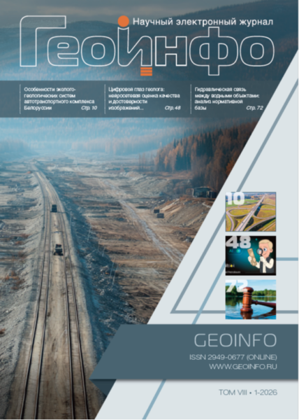
Signed for printing 11.06.2026
This article examines the ecological-geological systems (EGS) associated with the Belarusian motor transport sector. These systems, which play a key role in transport infrastructure and occupy significant territories, remain virtually unexplored, and existing information on their abiotic and biotic components is fragmentary.
The authors attempt to provide a comprehensive description of the EGS in the motor transport sector of the country using the classification of natural and man-made EGS in Belarus and the taxonomy of EGS in transport and communications systems that were previously proposed by them. The paper examines in detail the characteristics of their abiotic (lithotope, hydrotope, atmotope), bioinert (edaphotope), and biotic (microbocoenosis, phytocoenosis, zoocoenosis, and socium) components.
The obtained results and identified patterns may serve as a basis for understanding the features of similar ecological-geological systems in Russia, and they are important for conducting engineering-ecological studies.
The article considers a solution for optimizing the design of transport infrastructure subgrades in permafrost areas. Automation of calculating thermal settlements under embankments using numerical modeling speeds up data entry through the use of a command-line interface and of calculations for a large number of cross-sections. Thermal settlement is conventionally divided into settlement due to volume change during ice thawing (thaw settlement) and compaction settlement under load, and is determined as the sum of these two components.
This paper considers an algorithm for automating the authenticity control of core images obtained during engineering-geological investigations. The main objective of the development is to improve accuracy and reduce the risk of errors caused by the human factor during manual verification of photographic materials. The proposed approach includes three consecutive stages: automatic core segmentation in images, generation of a unique digital fingerprint using neural networks, and duplicate detection based on the comparison of visual features. The results of industrial validation demonstrate the high efficiency of the method: duplicate detection precision reaches 97%, while recall reaches 95%. The application of the technology makes it possible to accelerate the image verification process by more than three orders of magnitude, eliminate subjectivity in assessment, and significantly reduce labor costs. The method has been implemented as an industrial software solution integrated into the products of Soilbox and Digital Petroleum and is ready for scaling in large-scale projects with the possibility of additional calibration using corporate datasets.
The Arctic is rapidly turning into a region where an increasing number of complex and high-technology projects are being implemented. The success of these projects depends not only on engineering competencies but also on the quality of environmental data. Climate change, increasing industrial activity (including continental shelf development), and increasingly stringent environmental requirements are driving a growing demand for monitoring of ice conditions, hydrometeorological processes, and state of the marine environment.
At the industry round table “Remote methods and information services for the implementation of offshore projects”, which was organized by the Institute of Environmental Design and Engineering Surveys (IEPI JSC), representatives of science and business discussed key challenges and practical tools for risk management on the offshore shelf. Special attention was given to digital geoinformation services that enable the rapid collection, processing, and storage of data, the visual representation of monitoring objects, as well as access to information for a wide range of specialists.
The article is devoted to a comprehensive analysis of the concept “hydraulic connection between water bodies”, which is a key criterion for determining the legal status and use regime of water resources. The aim of the study is to analyze the regulatory framework and propose recommendations for establishing hydraulic connection between water bodies. The relevance of the topic stems from the legal implications, gaps in regulatory documents, the complexity of expert assessment in certain cases, and the growing number of disputes between landowners and regulatory authorities.
The paper examines interpretations of the concept under consideration in the context of regulatory definitions of groundwater supply types for surface water bodies. Despite the absence of a direct definition of this concept in regulatory documents, the careful reading and combined analysis of the regulatory provisions, which were presented in the article, reveal key indicators of the concept.
The author proposes methodological recommendations for conducting expert assessments to determine the presence or absence of a hydraulic connection between water bodies on the basis of the analysis of regulatory documents and expert practice.
The article is intended for hydrologists, ecologists, lawyers, and specialists in water management and environmental supervision.
We present a slightly abridged and adapted translation of the paper “Water inrush hazard in Shijingshan Tunnel during construction, Zhuhai, Guangdong, China” written by Chinese specialists (Kong et al., 2022). It was published in 2022 in the journal “Safety” by the MDPI publisher (Multidisciplinary Digital Publishing Institute). It is an open access paper under the CC BY 4.0 license (https://creativecommons.org/licenses/by/4.0/) that allows it to be distributed, translated, adapted, and supplemented, provided that the types of changes are noted and the original source is referred to. In our case, the full reference to the original paper (Kong et al., 2022), which was used for the presented translation, is given at the end.
This short communication reports on a water inrush hazard during the construction of the Shijingshan Tunnel in Zhuhai, Guangdong, China. On 15 July 2021, a water inrush accident occurred at the construction site 1.16 km away from the tunnel entrance, resulting in 14 casualties. The purpose of this study is to investigate and discuss the water inrush process in this atypical case. The principal causes of this tunneling accident include the special geological conditions at the construction site, high hydraulic conductivity in the area that connects the underground water system and the overlying water body (the Jida Reservoir), and the impact of heavy rainfall. Moreover, four significant suggestions are proposed to prevent water inrush disasters: assessing the risk level in areas prone to water inrush; getting a comprehensive geological prediction based on borehole data and artificial intelligent methods; establishing a monitoring system during the tunneling process; strengthening the self-protection skills of construction workers.
 наверх


 Поделиться

 Поделиться
 Скопировать ссылку









 Скопировать ссылку
 Vk
 Telegram
 Viber
 WhatsApp


 Оформить подписку